
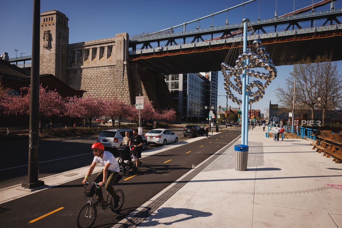
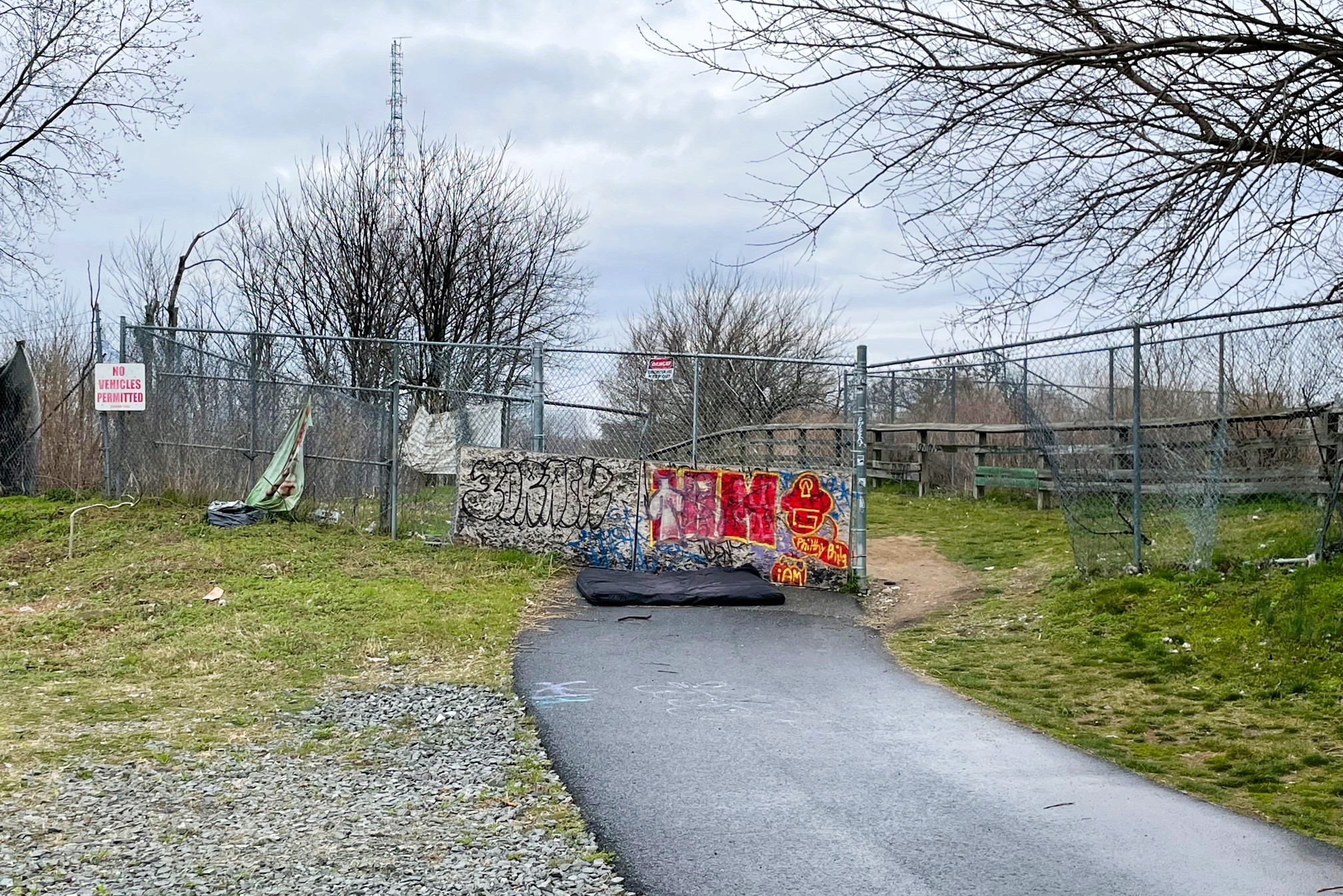
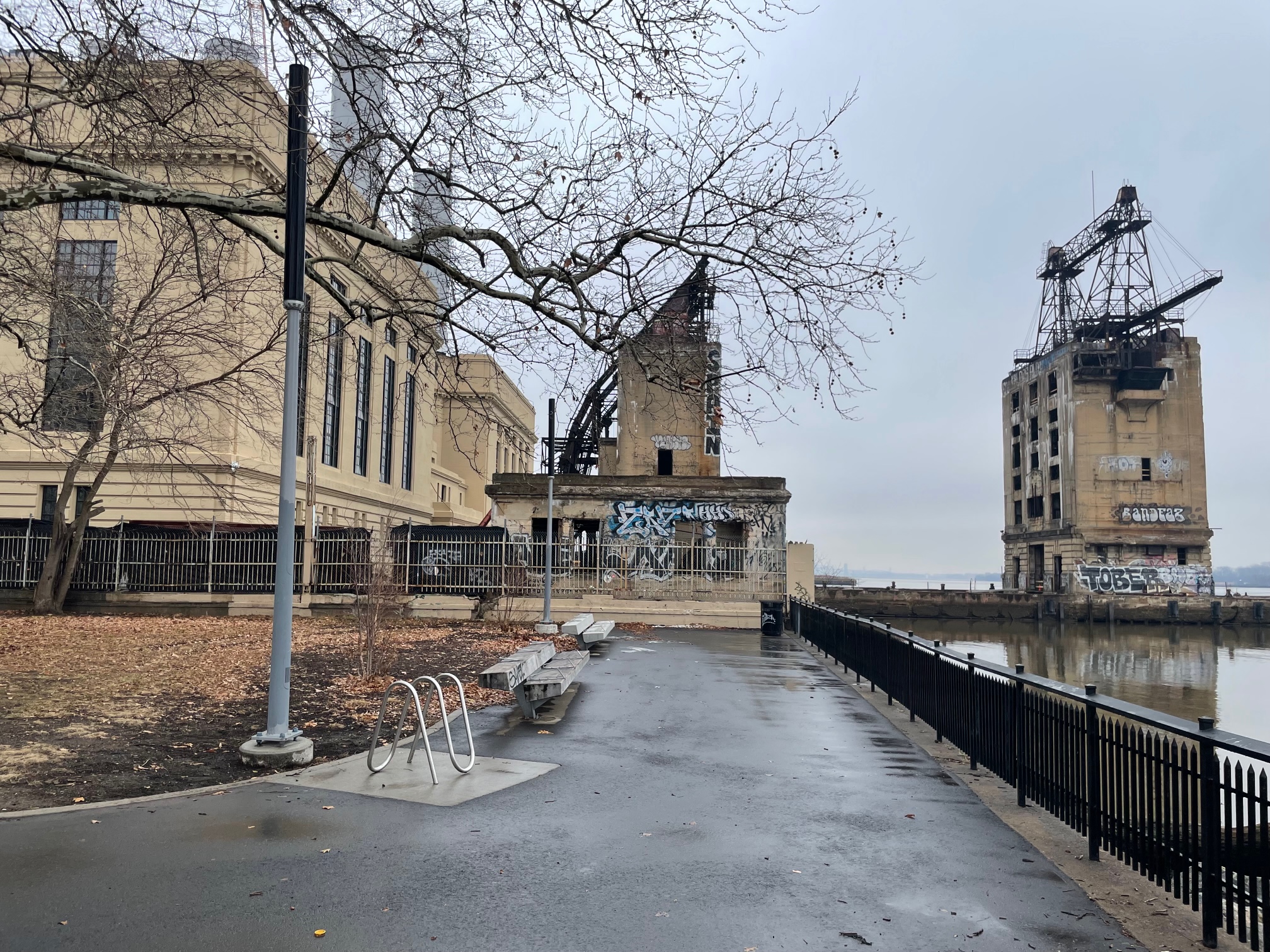
In just the few years of its existence, the Delaware River Trail has changed the city’s eastern waterfront wildly, with its 3+ mile stretch in the heart of town creating a place for all types of activity. However, the southern terminus around Pier 68 and the northern terminus at Penn Treaty Park are less welcoming than the central portion of the trail. Luckily for us, the plans for the northern end should change that soon enough.
That’s right folks, with all of the redevelopment happening at the Battery just north of Penn Treaty Park and the sprawling Northbank neighborhood just south of Graffiti Pier, a new trail planning study is underway. This would expand the borders of the existing trail, connecting the path north toward Lehigh Ave., which also received plenty of new pathways as part of Revive 95. But enough talk, let’s check out some maps to get a better picture.
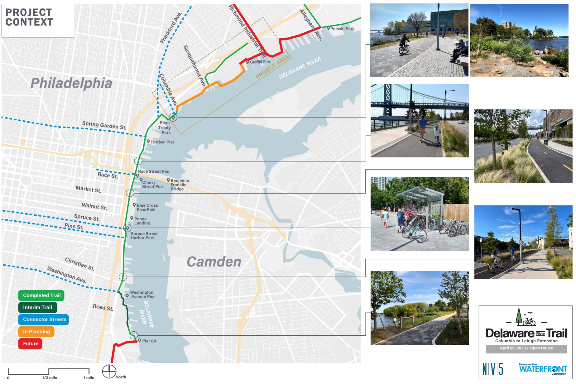
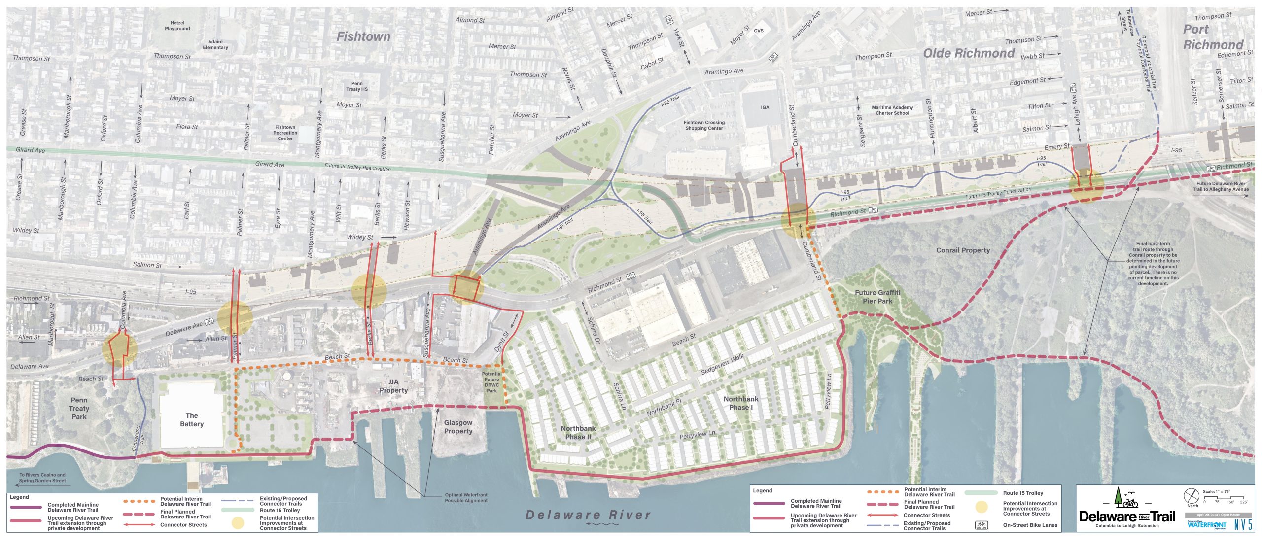
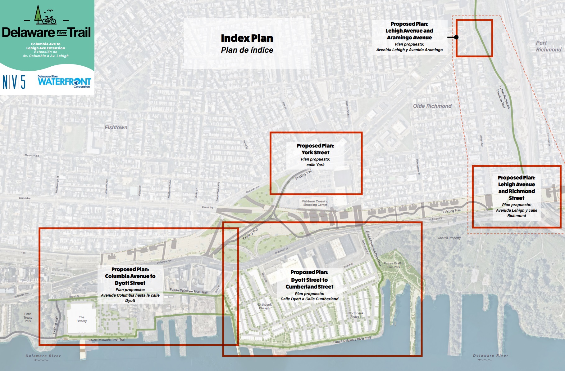
As the last map shows, the Delaware River Waterfront Corporation has identified some key focus areas and has been gathering feedback on what the future should look like. Not only is there a focus on the areas through and around the two massive developments we touched upon, but there is also a focus on connecting the river trail to the surrounding neighborhoods, leading to some interesting plans just off the water. Let’s check out the site plan for the portion near the Battery before we breakdown the deets.
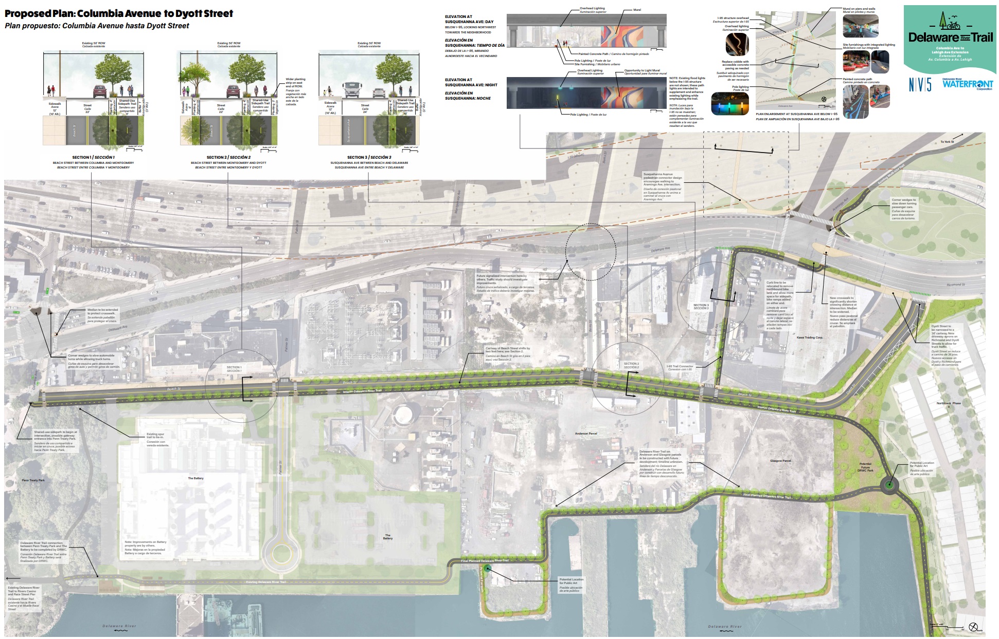
Currently, the trail ends suddenly at the end of Penn Treaty, with a fence preventing access to a portion of the trail that has been in the works for a while. While we await the future phases of the Battery to the north, which would abut the waterfront, a temporary trail will be added along Beach St., offering a convenient continuation of the trail just off the river. Additionally, improvements to the key intersections will be added, making it safer and easier for bicycles and pedestrians to make their way to the water. These changes also include landscaping additions, softening an area that is currently a mess of dilapidated roads that sit between what are now industrial and commercial spaces.
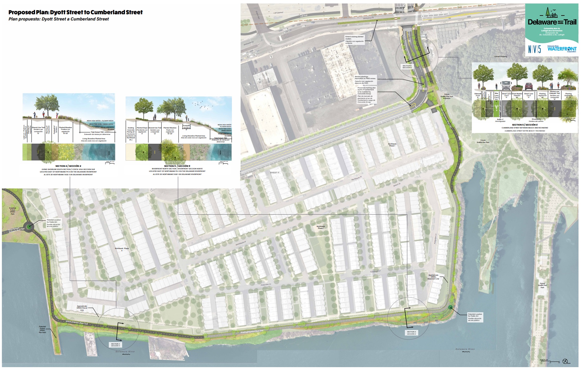
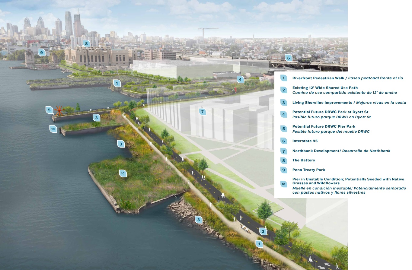
Continuing north, the trail would connect with the Northbank development, which already has a twin trail around much of the site: an inner sidewalk for residents and an outer path for walkers/bikers. The most exciting part of this section is the inclusion of park space on either side of the heavily residential neighborhood, creating a buffer from the public uses to the north and south. Additionally, improvements around the E. Cumberland St. intersection will make getting into and out of this new neighborhood safer, somewhat helping the current precarious pedestrian environment in the area.
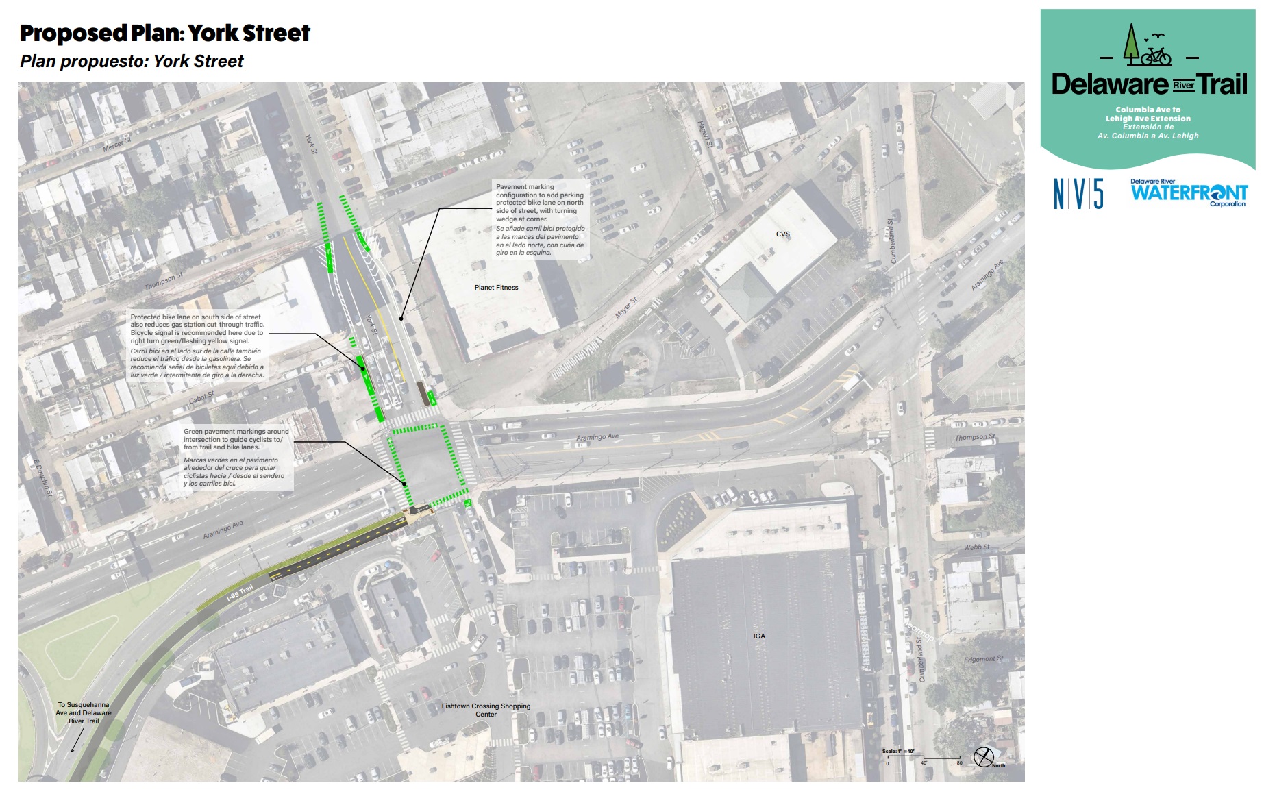
Making our way west a bit, the intersection of York & Aramingo at the Fishtown Crossing shopping center is also eyed for some much-needed improvement. New road markings and protected bike lanes would create a much friendlier approach for those on bike or foot, as the area is a car haven, with highway on-ramps and speeding drivers a looming presence along the border of Fishtown and Olde Richmond.
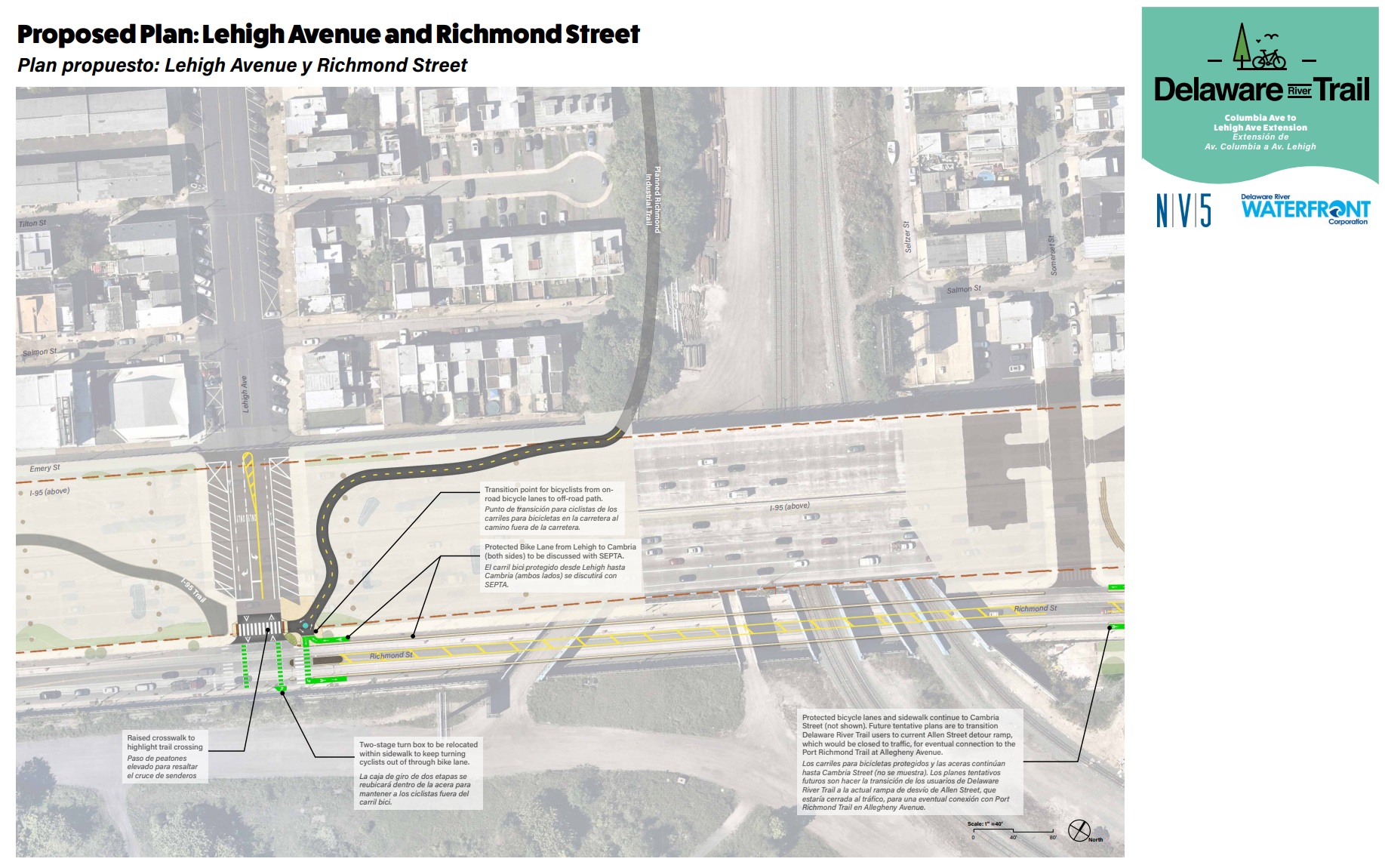
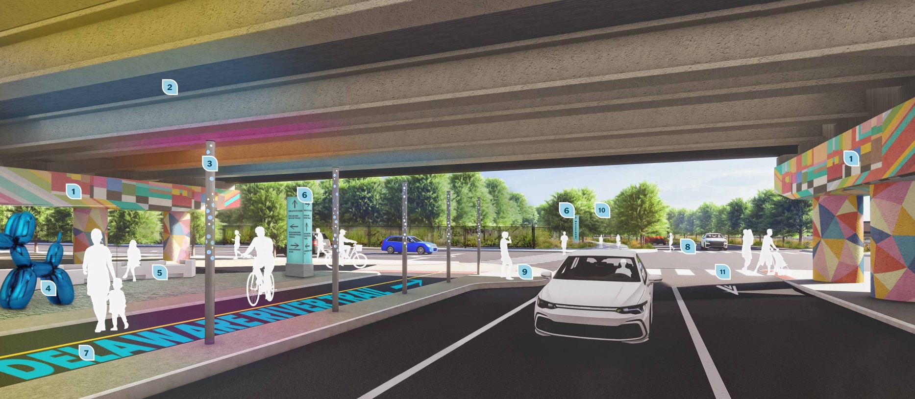
The intersection of Richmond & Lehigh also has plans in the works, as this area is a key node to connect with the already completed trails that sit under 95. The key feature to this improvement would be to get bicyclists off the road (despite the newly painted bike lanes on Lehigh Ave.) and up onto what could be the most exciting piece of all.
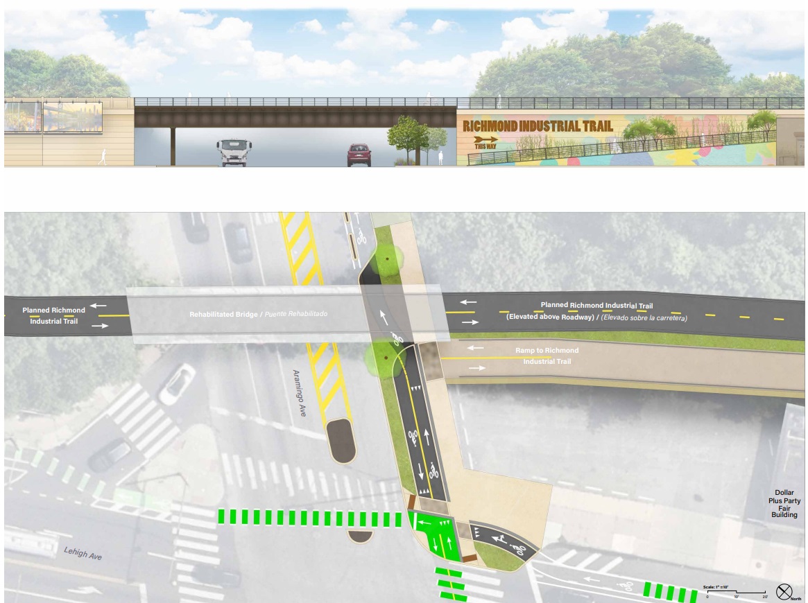
The last piece in these future plans is somewhat we’ve hinted at previously: a reimagined Richmond Industrial Trail, which would utilize the existing viaduct and turn it into a multi-modal path. This trail has plans to connect from the waterfront through Kensington and into North Philadelphia, creating what would be a wildly exciting new way to traverse this part of the city. While this is still a long way off, it sure is fun seeing these grand plans incorporated with others to form a more cohesive network across town.
Needless to say, we wish these improvements were finished yesterday. Providing safe, beautiful, and fun alternatives to car mobility is exactly what this area needs, as the increased presence of pedestrians and bikes along the completed part of the trail is impossible to ignore. These new developments need to be connected to the city, and what better way than by creating the opportunity for folks to mosey out their front door, whether to get into the existing neighborhood, or to get out of the neighborhood to explore the new offerings of the waterfront. Oh, and it’s not too late to have your voice heard, as feedback is still being gathered to firm up the future plan. Let’s hope that the money and the will are as copious as the grand designs, as a fully connected waterfront would propel Philly even higher on the list of best places in the universe.
Leave a Reply