
Ahoy mateys! Land bouy, dead ahead!
A land bouy, of course, is both beacon and wind monitor. It tracks the current of the sky with a sail that produces a deep, haunting sound when moved by the wind. And it’s also the art concept proposed to serve as a gateway to Pier 53, and scheduled to be constructed as part of Phase II of the green infrastructure project Washington Avenue Green.

Two summers ago

A land bouy, coming soon
Located at Washington Avenue and Columbus Boulevard, Pier 53 once served as Philadelphia’s equivalent to Ellis Island. It was constructed in the mid-nineteenth century, according to Delaware River Waterfront Corporation (DRWC) spokesperson Lizzie Woods.

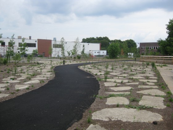
Entry to the park on Columbus Blvd., which is currently not very clearly marked
Phase II of the project will seek to build on the initial one-acre greening improvements fabricated in 2010, and continue to improve access to the river. The DRWC board of directors reviewed the plans in late April. The plan still needs to be reviewed by the Army Corps of Engineers and the Pennsylvania Department of Environmental Protection. The $1.5M project is funded in part by the William Penn Foundation, the Pennsylvania Department of Conservation and Natural Resources and the City’s capital funds, according to Woods.
“The idea of the park is to enhance the fact the Pier was returning to nature on its own,” says Woods. Some places have become “overgrown with vegetation… The idea of this project is to formalize that process and energize it and create a viable ecological site.”

Site plan for the future
The extension of Pier 53 will create about an additional acre of green space, according to Woods. It will also include riparian planting, soil lifts, boulders, a small area for fishing, beach access, seating, and a path. The Land Bouy art concept, designed by Jody Pinto, will reach 55 feet into the sky. The 16 foot sail is capped by a 55-foot phosphorescent glass structure. At night, LED lights will illuminate the sky, thus making it easily visible as one drives along Columbus Boulevard. Future plans, according to Woods, mark Pier 53 as the northern boundary of a 30-acre wetlands park, bordered on the south by Pier 70, by the Wal-Mart. When Phase II plans were announced in 2010, one of the ideas was for floating wetlands that would extend as far into the river as Race Street Pier. That thrilled us, but according to Woods, further research determined it to be unfeasible, as a dramatic changes between high and low tide affect the area significantly.
“We’re trying to really reflect the sort of natural condition that exists there now,” says Woods. That means “recognizing we’re not gonna go back to the way things were in 1650.” Back then, millions of shad filled the waters. Stay tuned as we follow the progress of Washington Avenue Green Phase II.
And watch out for those land bouys, me hearties!
–Lou Mancinelli
Leave a Reply