
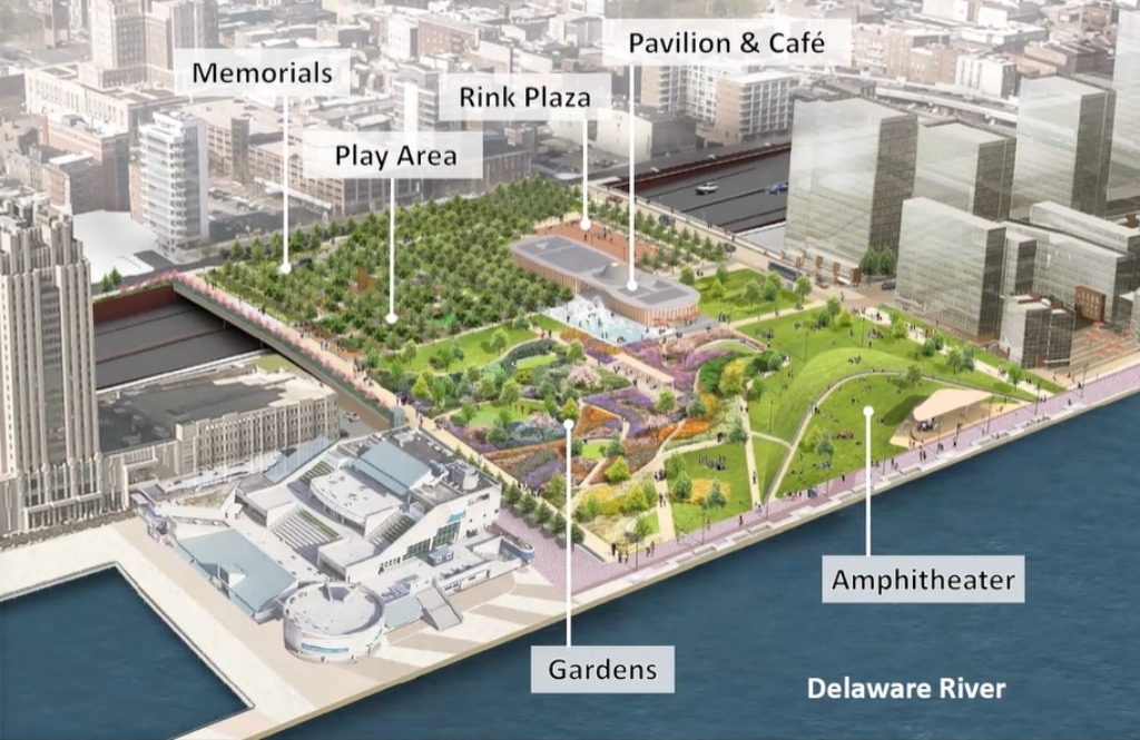
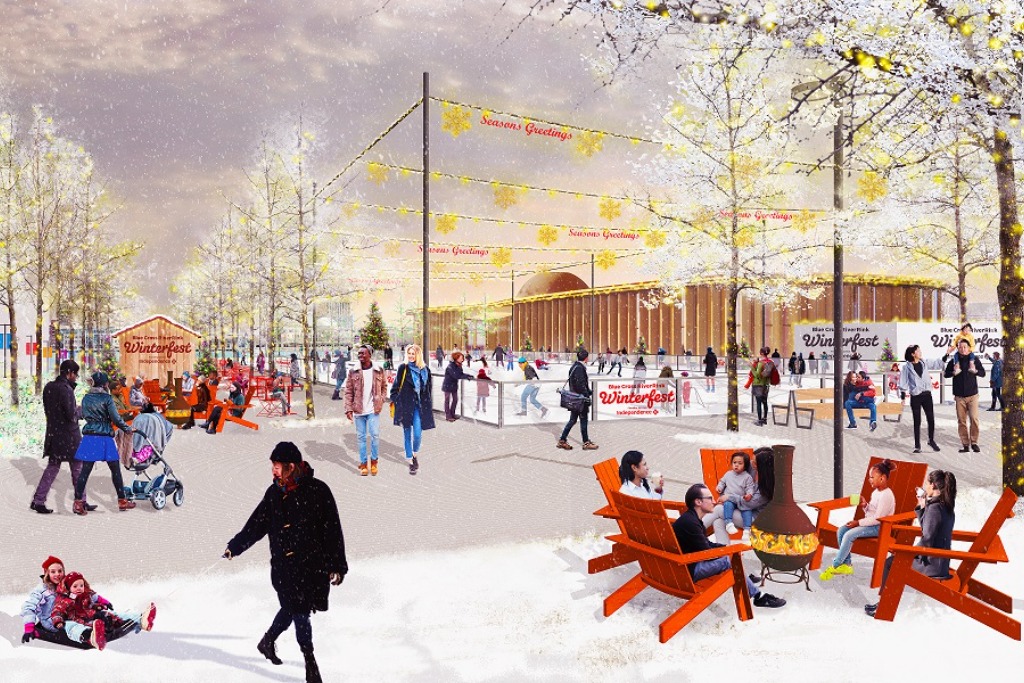
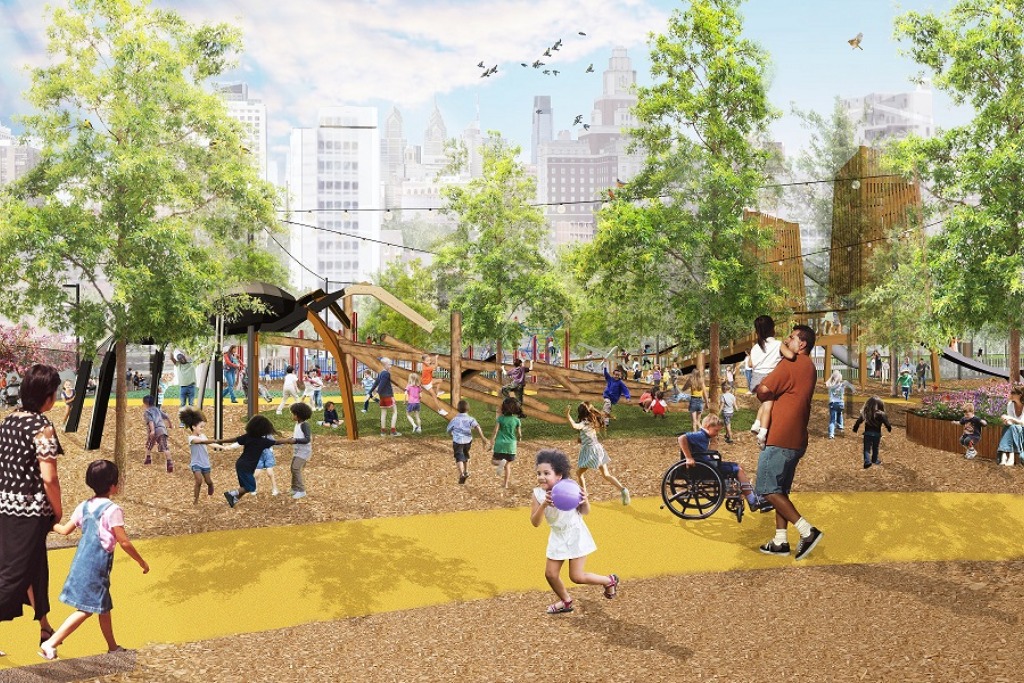
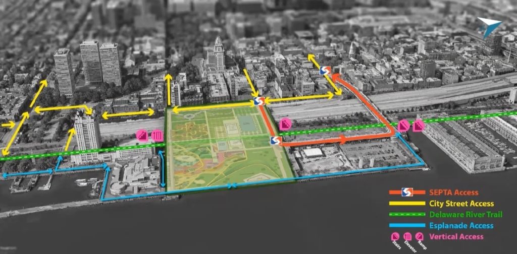
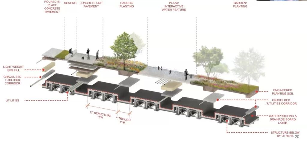
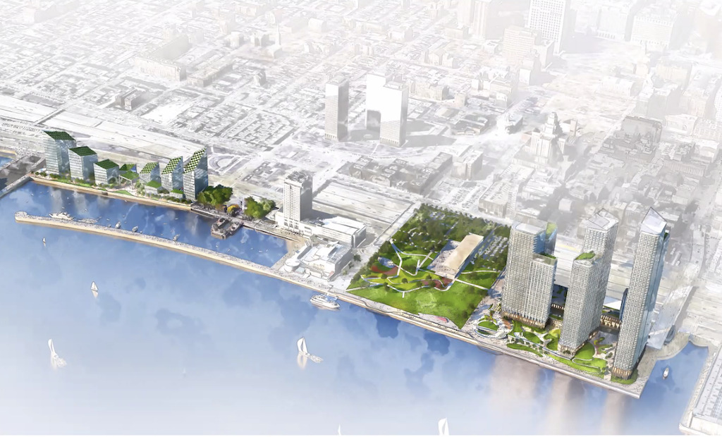
If it seems to you like it’s been a long time since we first told you about the Park at Penn’s Landing, you’d be correct! It was back in 2013 that we first mentioned plans for the park, as imagined by the Delaware River Waterfront Corporation. When this project happens, an eleven acre sloping green space between Chestnut & Walnut Streets will reconnect Old City to the river’s edge, covering the chasm created by I-95 and Columbus Boulevard. Last October we reported on the most recent plans for the park, which refined the vision and features after years of community feedback. Check out the aerial of the layout and some renderings for a quick reminder of what’s coming, thanks to HargreavesJones and KieranTimberlake.
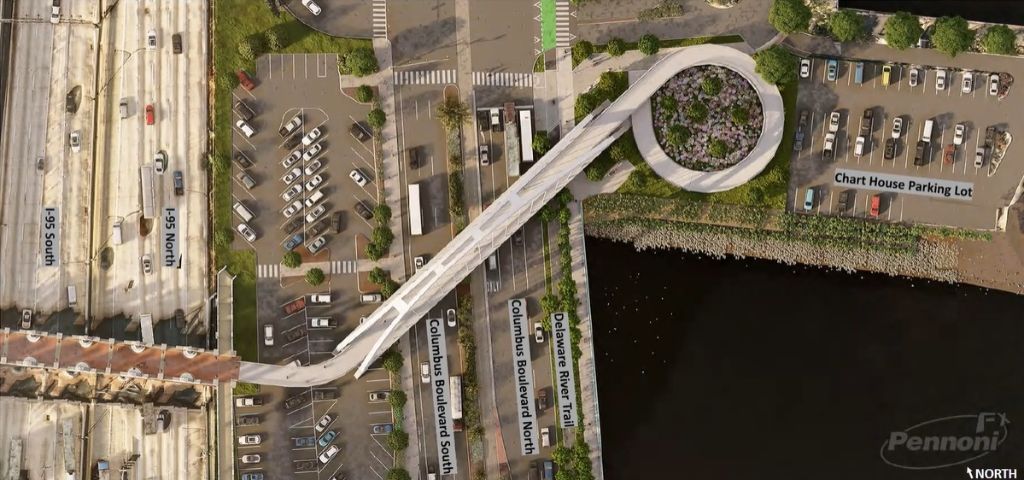
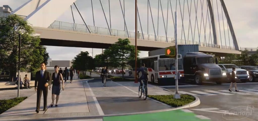
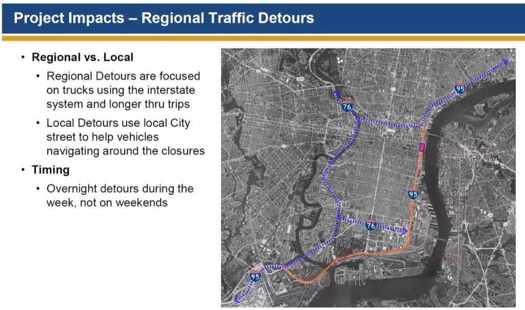
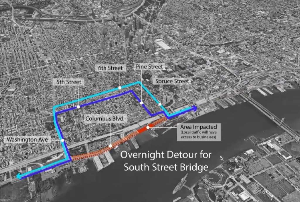
When we heard about a presentation in late March from the Society Hill Civic Association on the traffic impacts of I-95 and Columbus Blvd. construction, we decided to dip in to see what we could see. We were pleasantly surprised to hear not only about the impending start of construction in 2022 (a step up from a previous announcing of a 2023 start), but also additional new information about the circulation, transit and pedestrian plans. Check out the diagrams below to see how the park will connect to the surrounding area from a transportation perspective.
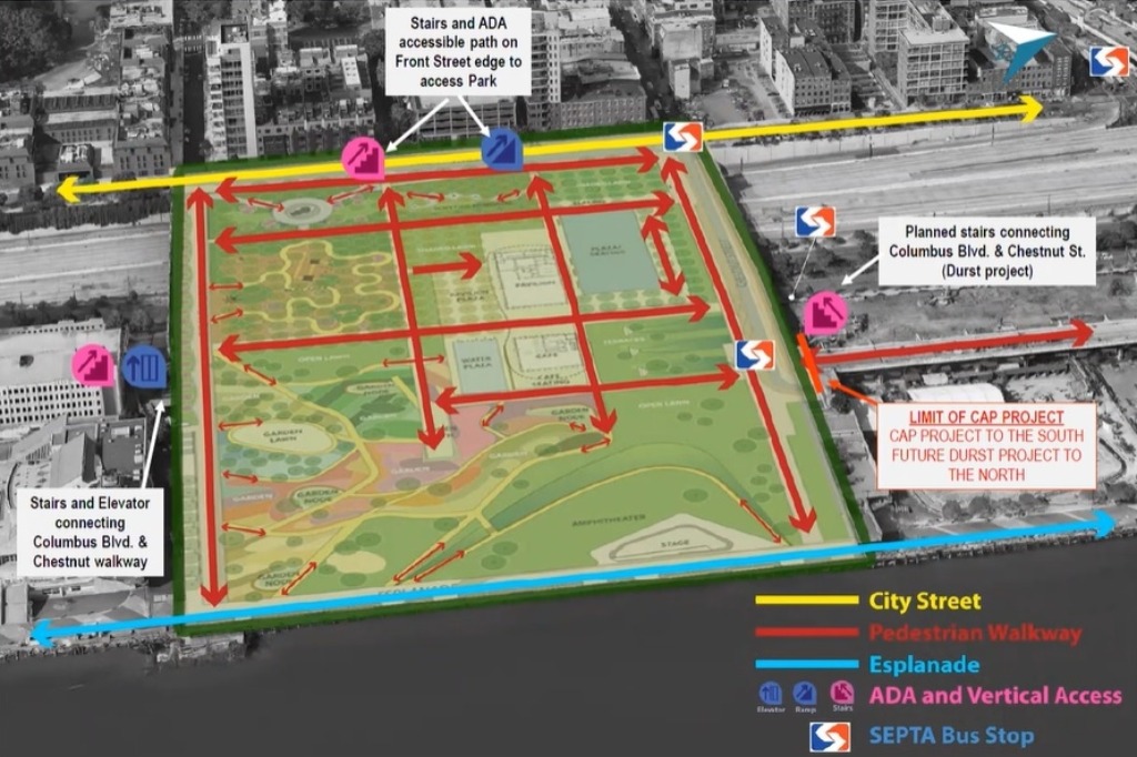

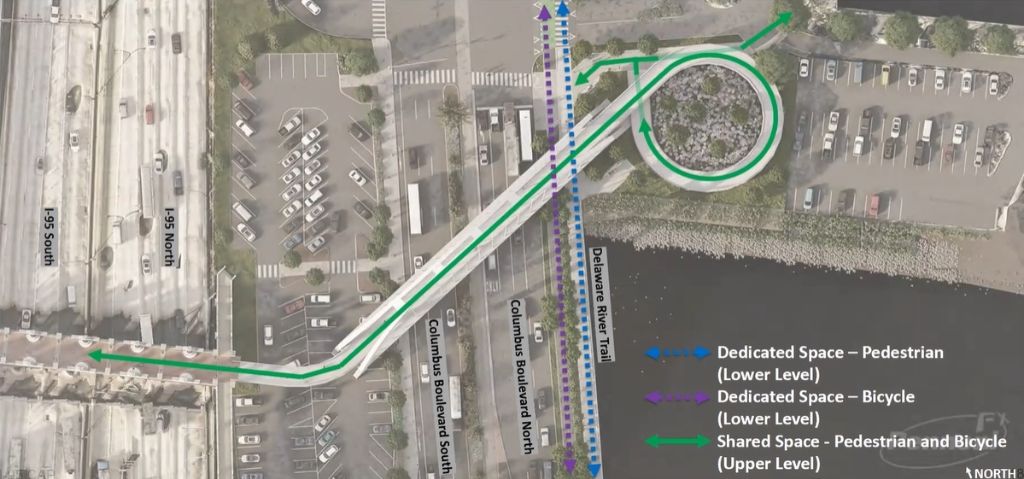
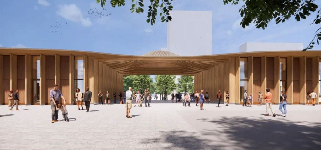
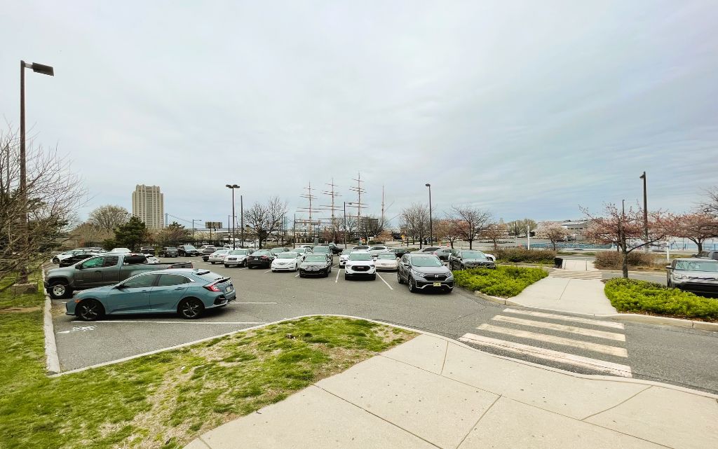
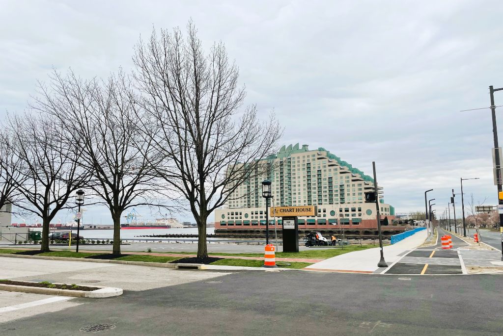
Perhaps the biggest piece of new information from this presentation is the site plan and renderings of the extended South Street Bridge. For those familiar with the existing bridge, it terminates after crossing 95, with either a ramp or stairs leading you to a parking lot – not exactly what one would expect given the signage. The existing bridge will remain as is, but will eventually extend over Columbus Blvd., ending in the parking lot of the Chart House restaurant. Not only will this bridge allow pedestrians and bicyclists to directly connect to the nearly finished Delaware River Trail, but it will serve as a pretty amazing looking gateway to the new riverfront park.
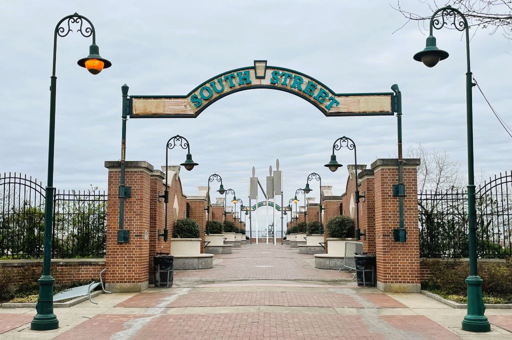
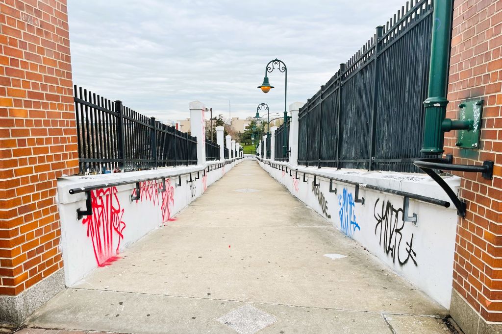
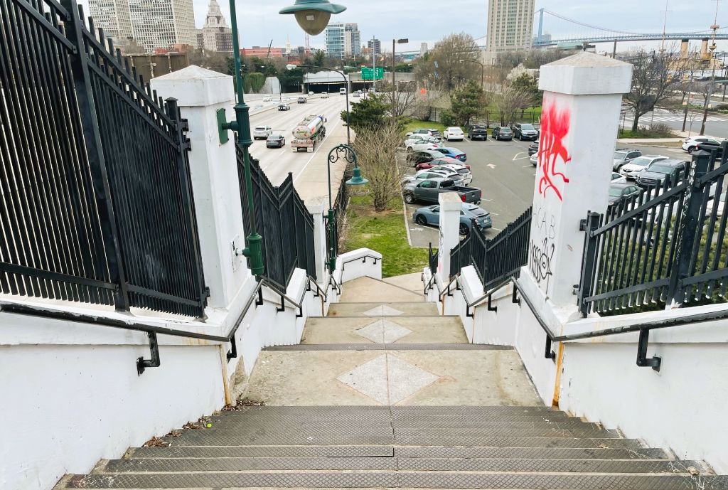
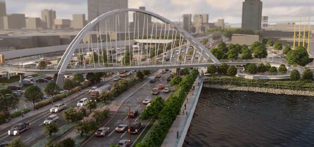
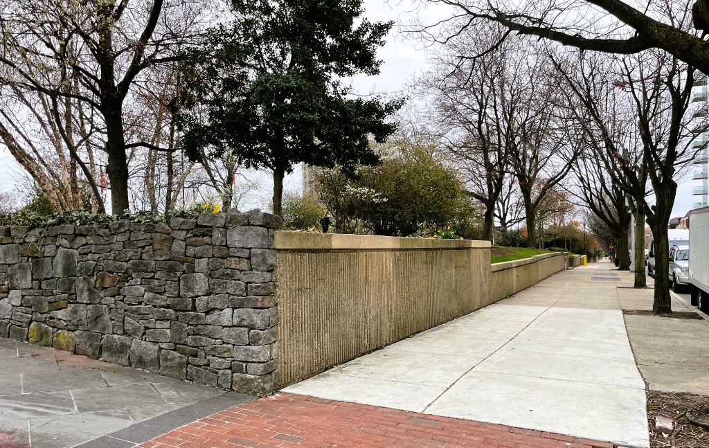
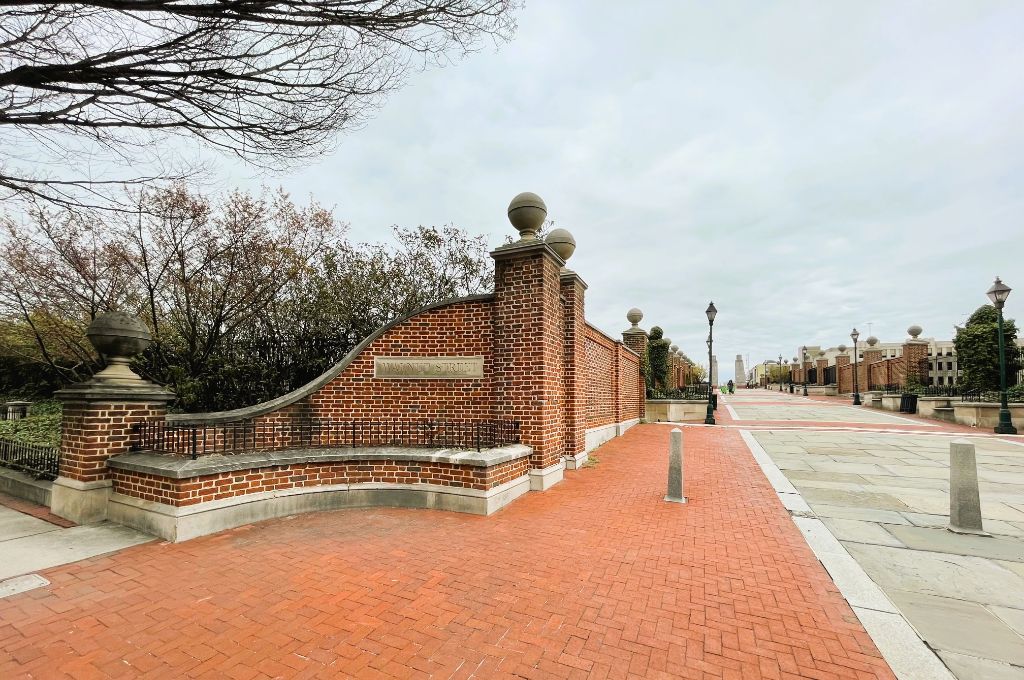
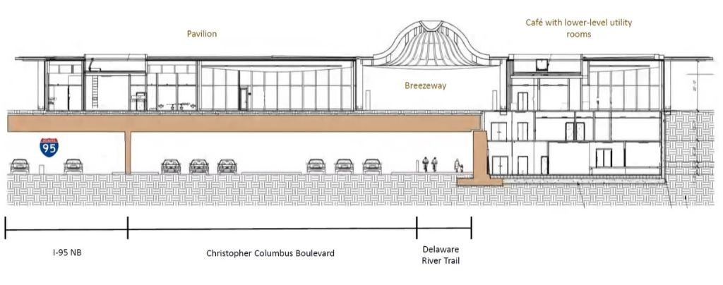
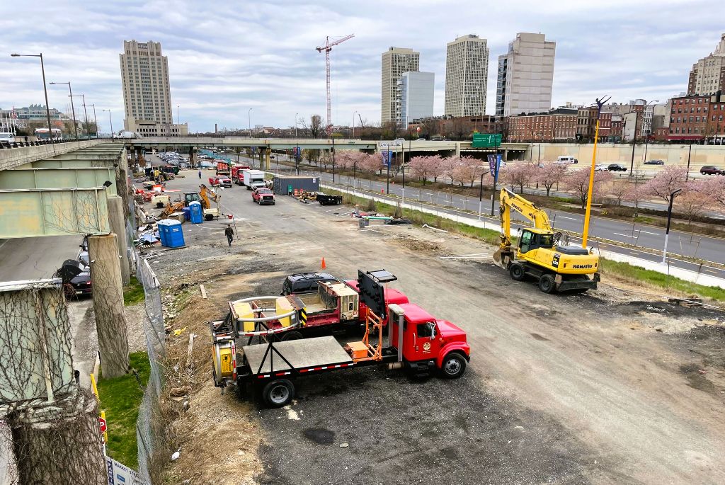
This is a terrific and much needed upgrade. Residents of Society Hill, Queen Village and beyond will no longer have to sit at the base of a 95 ramp to cross a busy street to access the waterfront. Having the additional landscaping take the place of a rarely used parking lot will add even more softness and freshness to an area that is anything but. That’s not the only piece of infrastructure going up, as the huge deck on which the park will be built needs to be put in place. This will consist of removing the existing smaller cap and adjusting the layout so that more at-grade access will greet visitors instead of the current brick walls and bushes. The present state is far from welcoming, but thanks to some snazzy engineering, the new park will greet visitors and provide better line of sight to the water.
You may be saying by now, “Hey, I thought this was about timelines and traffic issues?” And it is! In addition to the fun information above, we did learn some less fun news: the Park will sadly not be ready in time for the July 2026 semiquincentennial celebration for the country’s 250th birthday (note: this is not an April Fool’s joke unfortunately). Construction will take four years total, meaning things should all set late in 2026 if things do indeed commence later this year.
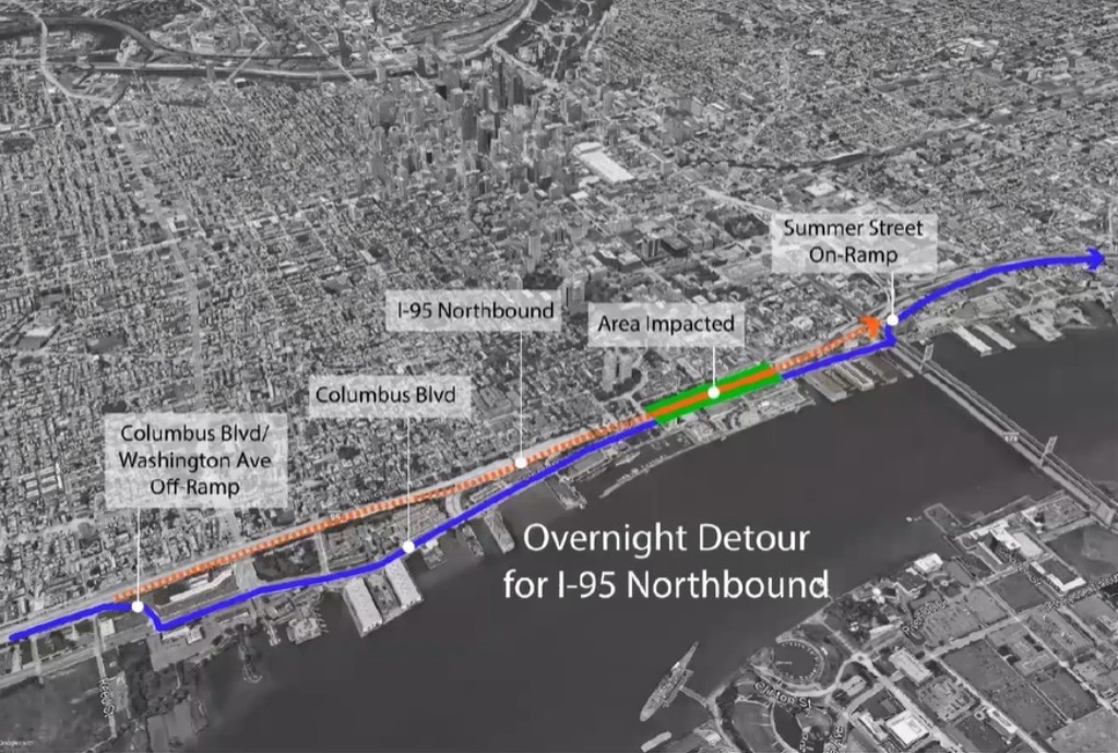
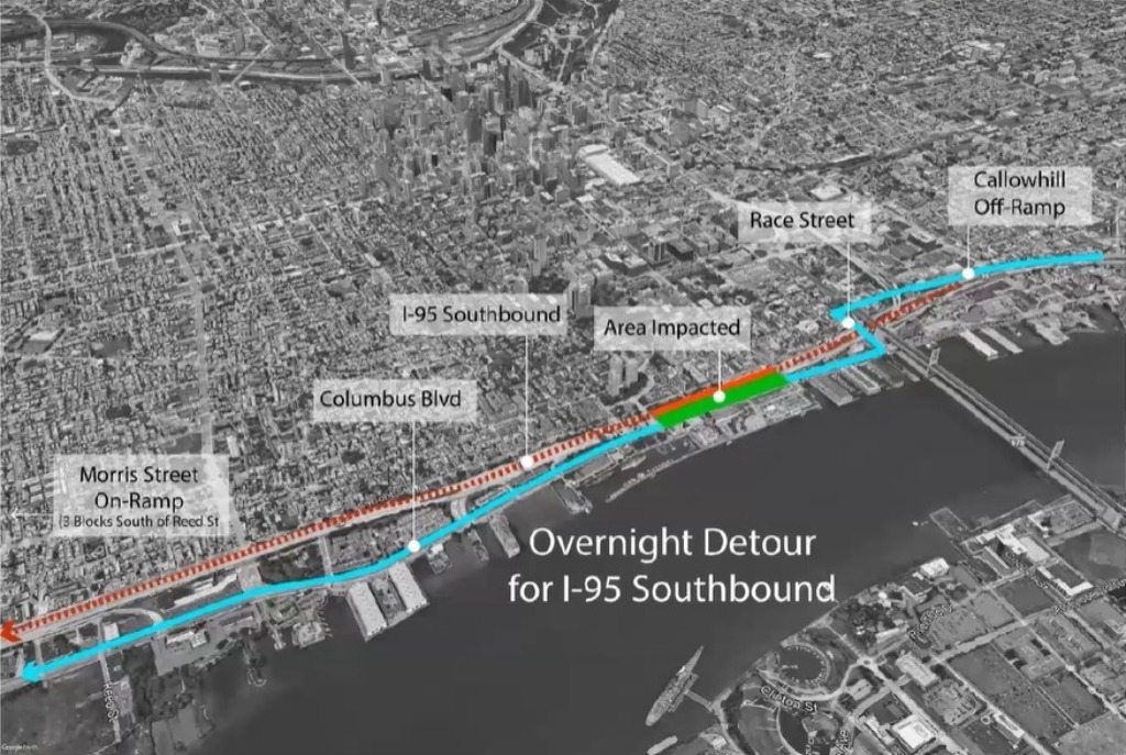
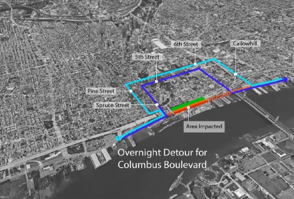
Traffic-wise, we were able to get some specifics about the planned detours for both I-95 and Columbus Blvd. construction. Any and all closures will take place at night and only during the week to avoid major traffic issues. For I-95, both I-76 and I-676 will be used to reroute drivers passing through Philadelphia. For local travel on I-95, Columbus Blvd. will be the main road used for the detour. However, for Columbus Blvd. closures, traffic will be pushed to the residential streets in Society Hill and Old City. Local residents didn’t seem too pleased by this news, but traffic at 3AM on a Tuesday shouldn’t be terribly burdensome, or so we hope.
All of this news definitely makes this project feel both more imminent and more real. All funding is secured and things seem at long last to be on the move for the waterfront. When the massive Durst projects get moving in the adjacent areas, the entire waterfront will be completely transformed. Let’s hope we see some shovels in the ground soon, as this may be the most exciting and transformative project on tap in the entire city.
Leave a Reply