
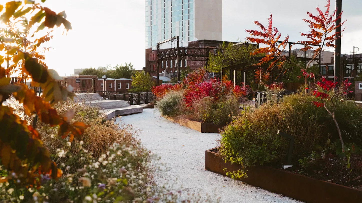
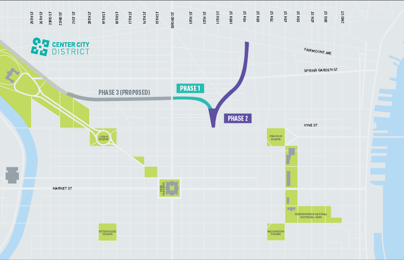
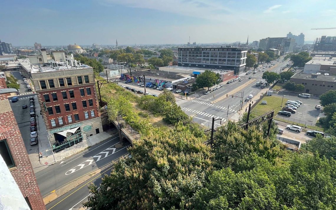
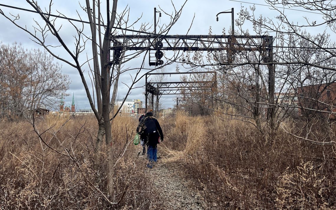
After opening six years ago, the Rail Park has become a staple for the several communities that surround the two-block stretch of converted, elevated rail lines in the heart of the Eraserhood. The push from Center City District and their design lead Studio|BryanHanes to create this aerial park – meant to rival NYC’s High Line – indeed built a gem of a spot, with future phases seeming like they’d be coming shortly. This elevated section was immediately adjacent to two other out-of-use set of tracks: a submerged portion running west dubbed the Cut, and a north-extending elevated section called the Viaduct.
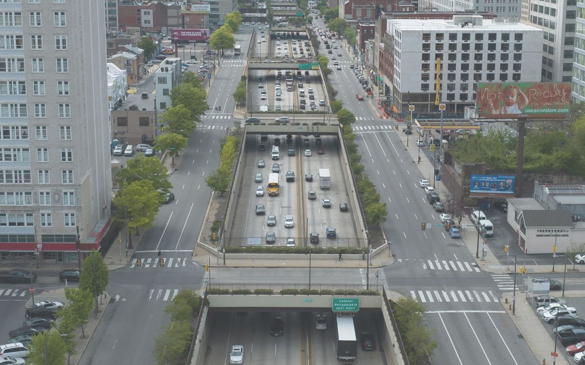
But after the initial rush of excitement, things have been quite quiet since. There have been some encouraging signs of progress here and close by, with some demo, the capping of the adjacent Vine St. Expressway to the south, and an RFI from SEPTA for the Cut. However, the footprint of the park remains the same as it did on the day it opened. That may change soon, however, according to a very exciting announcement about major steps for Phase 2.
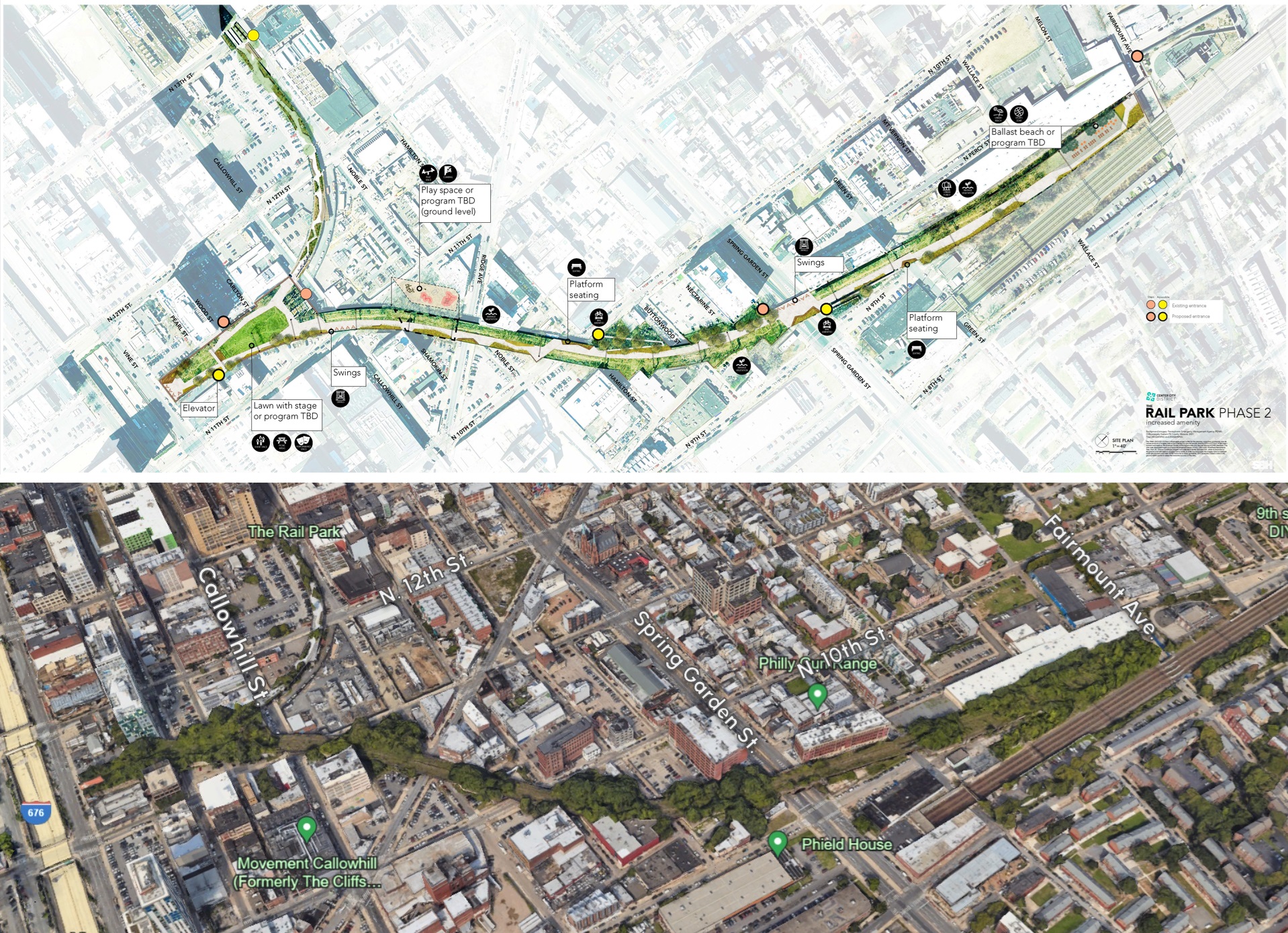
That’s right, the planning for the Viaduct has begun in earnest, leading the way for a major expansion from Vine St. to the south up to Fairmount Ave. in Poplar to the north. This phase of the park would add a huge boost of both public space and green space to this area as it cuts through several neighborhoods. Structural improvements, land remediation and basic pathways and lighting would be the first step of this next phase, with larger interventions coming later on after engagement with neighboring communities. The Friends of the Rail Park has brought together a large group of local stakeholders, including the Philadelphia Chinatown Development Corporation, the Callowhill Neighborhood Association, the 14th Ward RCO, and the West Poplar Neighborhood Association, with hopes to create “an elevated park that links diverse neighborhoods together with an active transportation trail.” While still conceptual in nature, the initial before-and-afters from Studio|BryanHanes give some tantalizing clues as to what a future state might look like here.
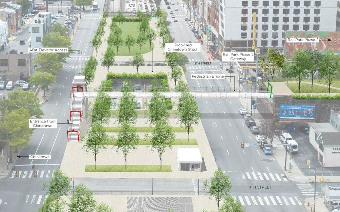
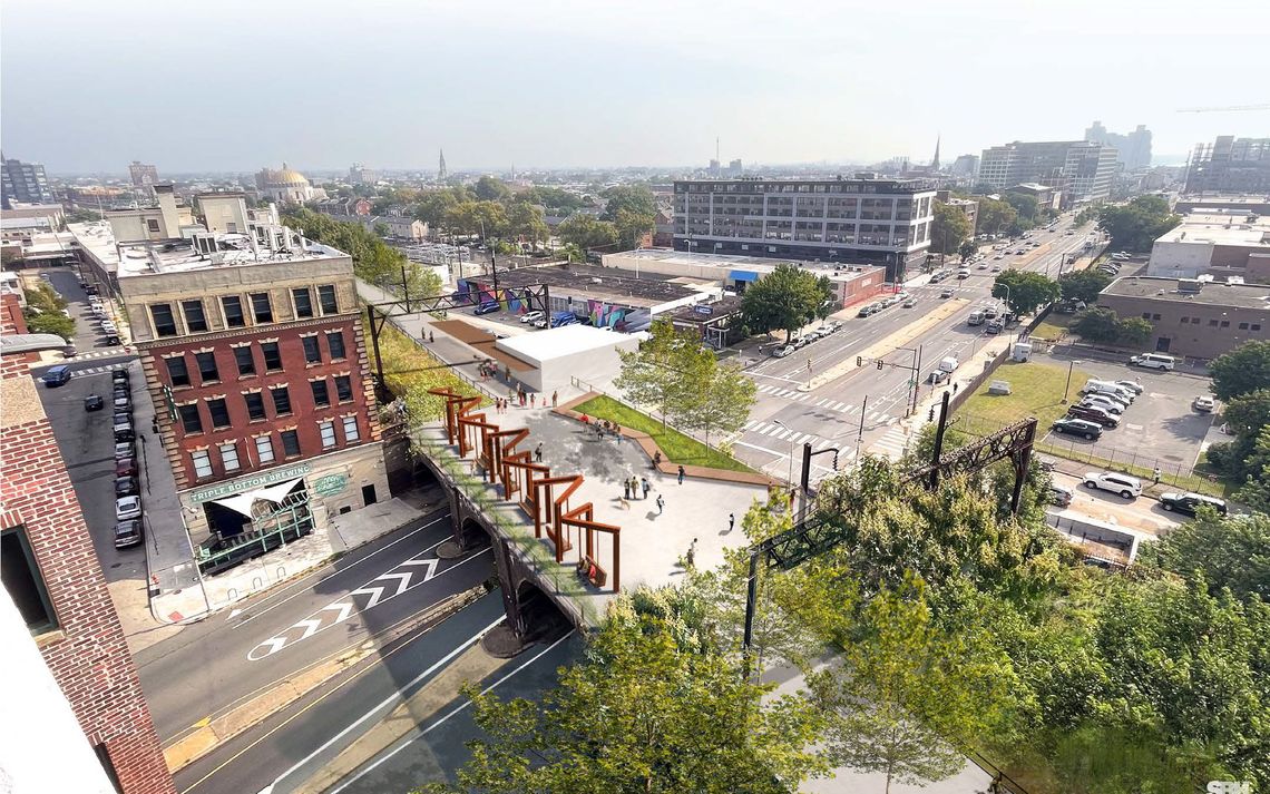

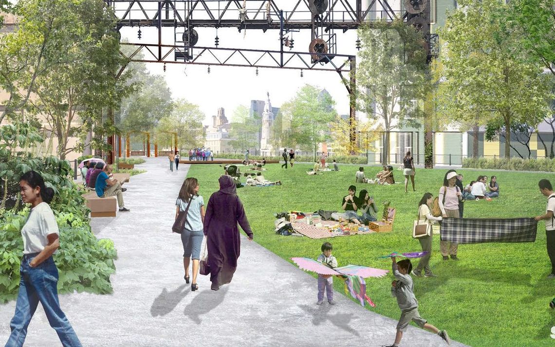

Despite the conceptual nature, seeing this type of real movement is incredibly exciting for the future of the park. While there’s only one more public event to provide feedback (tonight, June 11th at 6:00pm), there are still opportunities to take the survey, or provide feedback on the digital multimedia wall. And you might want to think about providing this sooner than later, as the fact sheet states that construction on the first pieces of this phase could come as soon as 2025. Being able to stroll from Poplar to Chinatown along an elevated, linear park? Being able to bask in nature smack in the heart of the Eraserhood? Yes, please – and with the plans already receiving funding through the state’s Industrial Sites Reuse Program and other sources, we hope to see tangible action here soon.
Leave a Reply